Item details: Paterson’s British Itinerary being A new and accurate Delineation and Description of the Direct and Principal Cross Roads …
£ 650.00
BOWLES, Carington
Paterson’s British Itinerary being A new and accurate Delineation and Description of the Direct and Principal Cross Roads …
Imprint: London, 1785 Edition:
First Edition
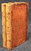
Two quarto volumes (190 x 120 mm.), full early marbled calf, gilt panel, rebacked and cornered, blind ruled bands on spine, gilt title and volume number. Original endpapers, with a Carington Bowles advert pasted inside front cover of first volume. With engraved general map of England and Wales in early outline colour, engraved title page, dedication, General Contents, preface 8 pp. and Index to the Direct Roads 29 pp. Volume 1 contains: 186 strip road maps (2 to a page) and then 40 pp. of distance tables. Volume 2: Engraved title page 142 strip road maps (2 to a page) 24 pp. of distance tables a further 30 strip road maps of the Cross Roads, 90 pp. of distance tables, Errata to the verso.
FIRST EDITION. Daniel Paterson (1738-1825) was commissioned in the army in 1765 and served in the Quartermaster Generals department until 1812. He made Assistant Quartermaster General for the last eight years before his retirement. He then became Lieutenant-Governor of Quebec. 'Patersons Roads' was first published in 1771 and it proved to be a popular work being published into the nineteenth century. It only contained one general map. In 1785 this rarer work was published by Carington Bowles running to only five editions. It is notable for including some of the first road maps of many parts of Scotland. Provenance: Bookplates of Mr. Brounger pasted inside both volumes; Charles Traylen; private English collection. Carroll (1996) Appendix 15; DNB; ESTC T93554; Fordham (1925b) pp. 344-55; Fordham (1924) p. 36; Shirley (2004) T.Pat 1a; Worms & Baynton-Williams (2011).